Mapping and GIS
Coal-Fired Power Plants built between 1900 and 2008 and the coal ash ponds and landfills associated with them build from a range of publicly available data for Unintended Consequence of Convenience (2020).
Tools Used
- ESRI ArcGIS Pro (time animation)
- Adobe After Effects
Animating the process engineers at Moffatt & Nichol used to build an atlas for targeting lands for habitat conservation in conjunction with The Mobile Bay National Estuary Program, The Alabama Forrest Resouces Center, and Alabama Wildlife Federation. Animated for use in Preserving the Mobile Bay Estuary Through Headwater Protection (2019)
Tools Used
- ESRI ArcGIS Pro (time animation)
- Adobe After Effects
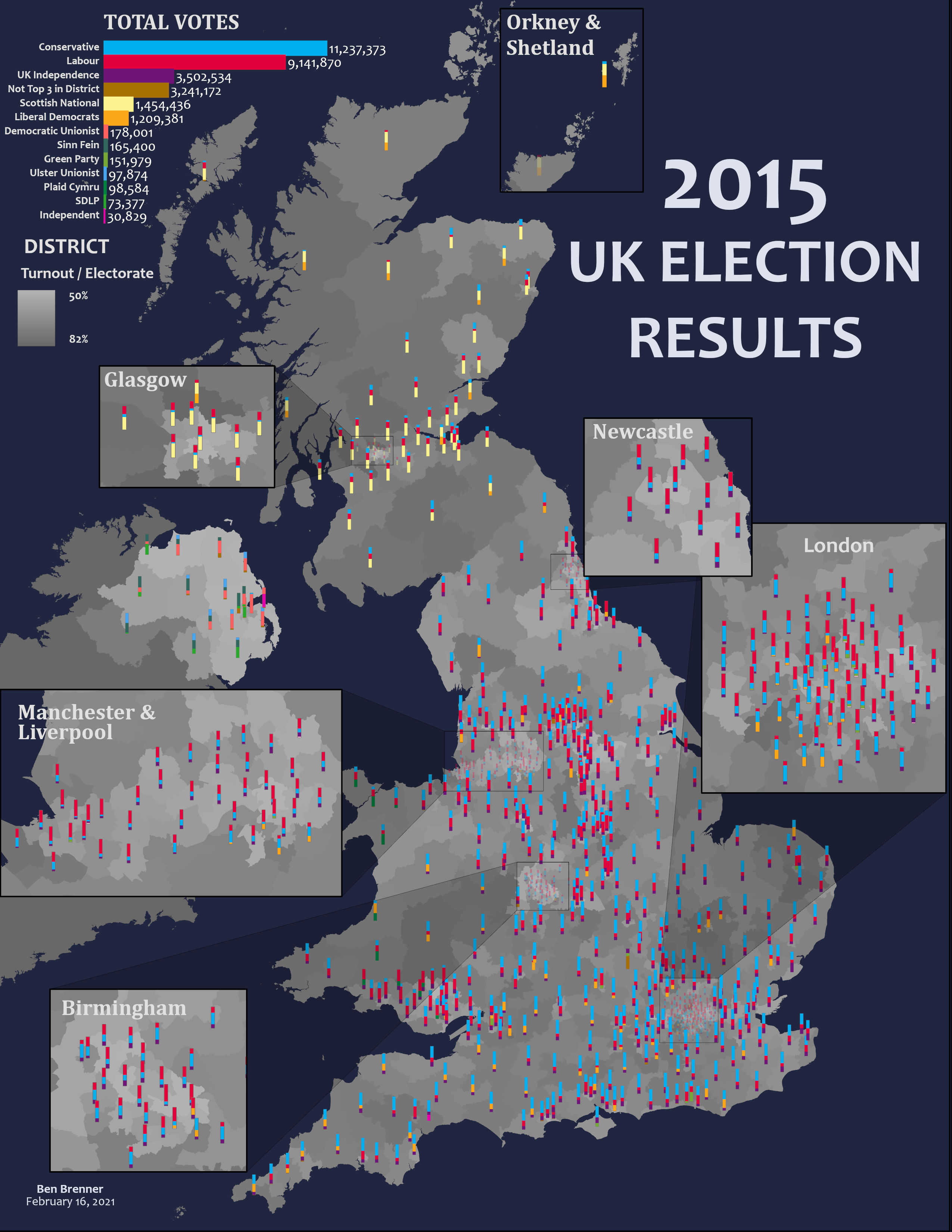
2015 UK Election map with charts showing turnout and top 3 party share per district. Designed as a stretch goal with the ESRI Cartography MOOC 2021